London Luton Airport (LTN)
City Orientation and Maps
(London, England)
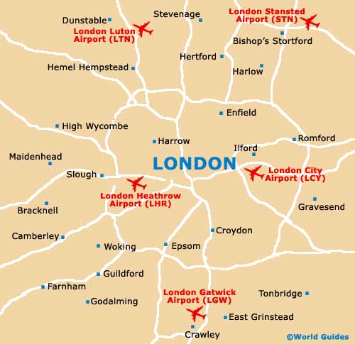
Luton lies to the north of London and is most famous for being home to London Luton Airport (LTN). The airport itself is within easy reach of London, being sited close to the M1 motorway, which connects to the M25 and a number of fast A roads.
Located in the county of Bedfordshire, other areas of significance nearby Luton include Stevenage to the east, Bedford to the north, Hemel Hempstead and Waterford to the south, and Dunstable to the west.
London Luton Airport (LTN) Maps: Important City Districts
Many people flying into Luton Airport head straight for the big smoke that is London, where a host of impressive sights await. The city is easy to traverse, with both underground trains and buses being the most popular forms of public transport.
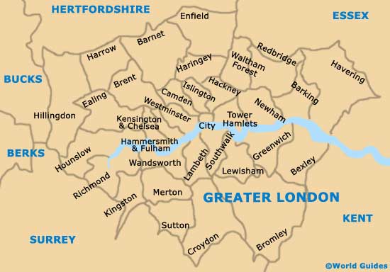
Prominent districts within the city of London include Chelsea, Chinatown, Covent Garden, Earl's Court, Hampstead, Hyde Park, Kensington, Knightsbridge, Mayfair, Notting Hill, Piccadilly, Regent's Park and Trafalgar Square. The city is divided by the River Thames, which meanders past many places of interest. These include the Tower of London, Tower Bridge, Southwark Cathedral, the London Eye, the Houses of Parliament and the Docklands, which incorporates Canary Wharf.
England Map

Greater London Map
London Map